From OFP photo to a clear verdict.
These are the real screens of the FlightBrief iPhone app. Photograph your OFP or type a VFR route, and live weather, NOTAMs and your own limits collapse into one advisory Go / Caution / No-Go — with the reasons right under it, and a passenger-friendly card for the people in the back.

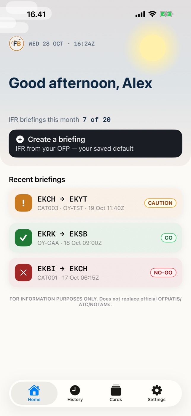
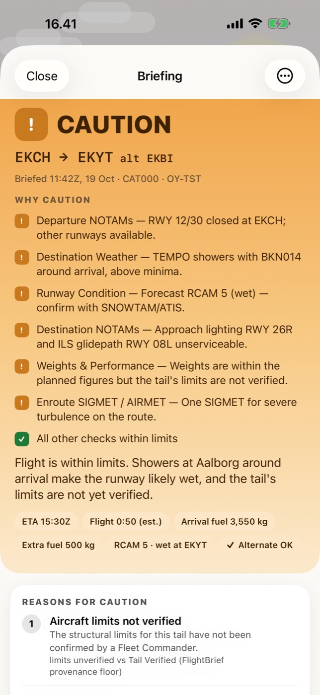
The verdict first, and why.
Photograph the OFP and the result opens on one colour: GO, CAUTION or NO-GO. Right under it, “Why caution” lists each reason in plain words — here a closed runway at departure, showers at arrival, a wet runway forecast and limits that aren’t verified yet. Arrival fuel, extra fuel and the forecast runway condition sit as chips below.
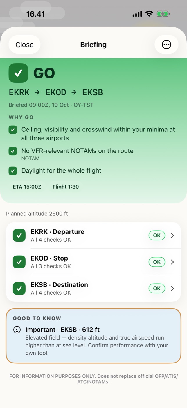
A whole route, airport by airport.
Type a GA route with stops and your aircraft. Every airport is checked against your own minima and your aircraft’s demonstrated crosswind, with daylight for the whole flight. “Good to know” flags things like an elevated field — awareness, never a change to the verdict.
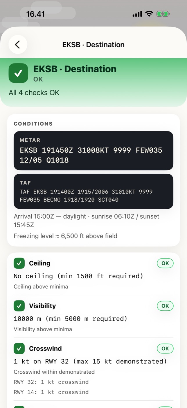
The raw data is one tap away.
Each airport opens with the raw METAR and TAF on top, arrival time against sunrise and sunset, and the freezing level. Then every check with the number behind it — ceiling, visibility, crosswind on each runway — so you can see exactly why it says OK.
Built to never give a false green.
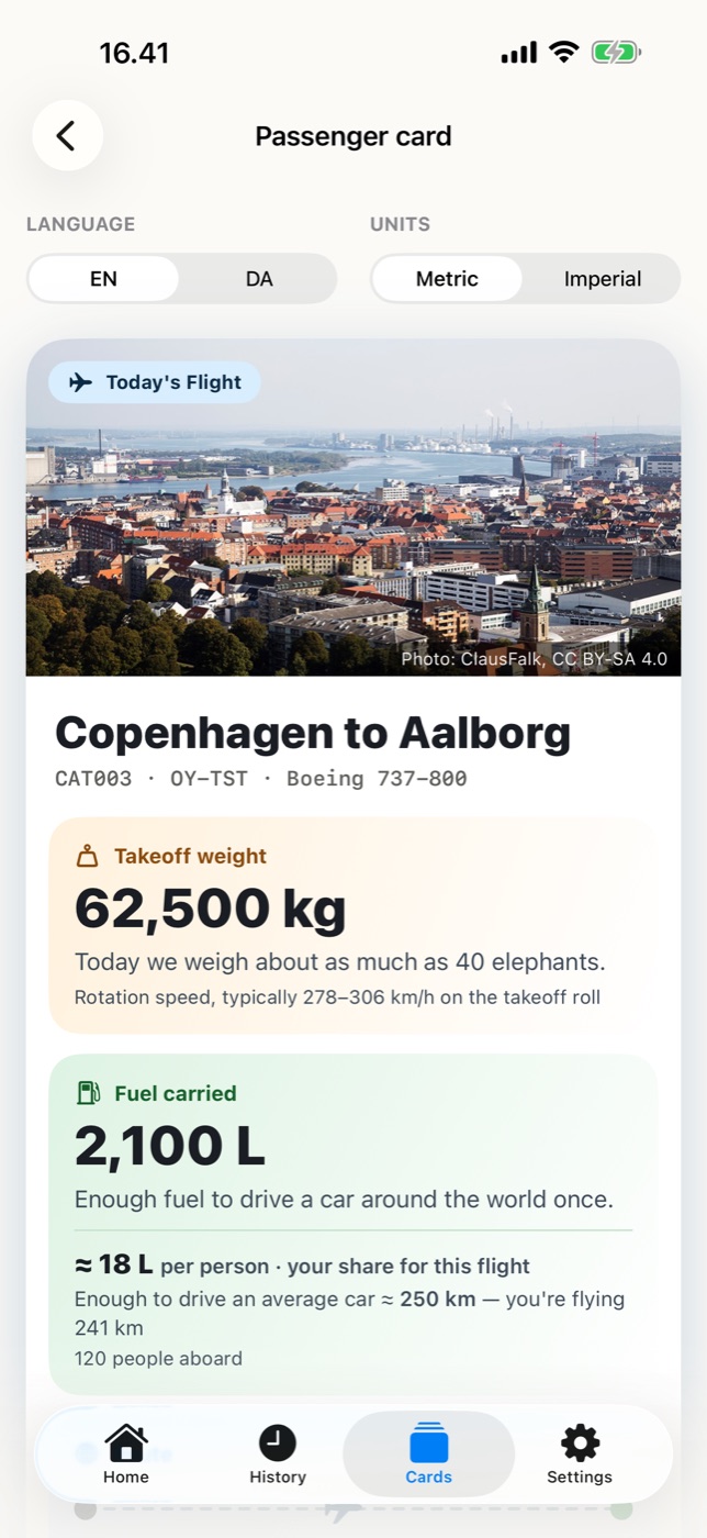
A card for the people in the back.
From the same flight, make a friendly “today’s flight” card — a photo of where you’re going, the aircraft, how much it weighs and how much fuel is on board, told in everyday comparisons. In English or Danish, metric or imperial. You choose when to make it; it is never sent on its own.
Hard data boundary. The card is built from an allowlist of passenger-safe fields only. NOTAMs, alternates, fuel by category and certified limits stay pilot-side — they can never reach the card.
Photograph your next OFP.
Sign up and run your first briefings free — no card required. Advisory only; official sources always govern and the PIC retains full authority.